Bells and Wild Horses
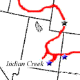
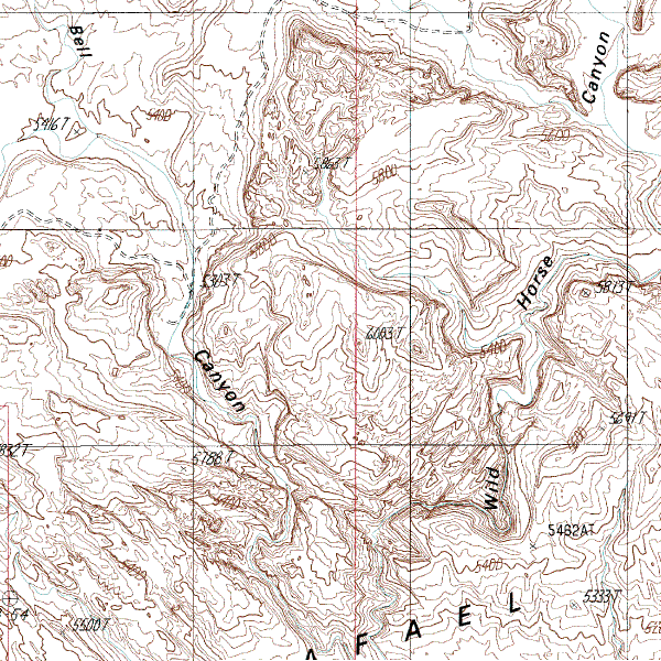
We woke with the sparrows, breakfasted in town (Moab is a bloody expensive place to eat) before heading north to the I-70, which we followed west a ways until we reached a south turn that would take us to a place called Goblin Valley State Park. We are specifically interested in doing some canyoneering here. John Peterson had recommended doing Little Wild Horse Canyon, and this is where it is. The guide book John loaned us explained a circular hike that followed out Bell Canyon to the other side of the San Rafeal Reef and returned via Little Wild Horse, an 18 km round trip. It was a hot day, so we took some water with us and some fruit and nut mixes for food. The hike was really good, the canyons were beautiful and varied. Sometimes broad and wide, sometimes so narrow that we had to walk in single file, but always very deep. The temperature changes were significant. The sun was fierce enough to drive us into any available shadows, and the shadows were very cool indeed. Coming through the end of Little Wild Horse we encountered large numbers of people. They were very very loud. It took us 3 hours total. Afterwards, burned by the sun and feeling hungry, we drove north back to the I-70 and found a nearby roadhouse to get food and drinks. We discussed our plans and decided that since the weather was so nice we should go north up to Wyoming and try and catch some action around the Tetons. The food made me very drowsy and I dozed while Leon, caffeined to the eyeballs, drove us north towards Wyoming. As we approached the border at Flaming Gorge National Park we drove across a snowy mountain pass. Uh oh. Haven't these people heard that it's Spring now? At Flaming Gorge we stopped to photograph the sunset and stare at the big dam there. Minutes later, as darkness fell, we passed into Wyoming. On the way to Rock Springs we nearly hit a pair of deer. Stopped for the night at an Econolodge.
|